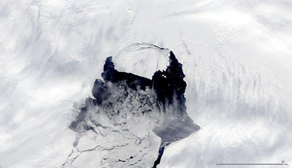
An iceberg which was part of the Pine Island Glacier is shown separating from the Antarctica continent in this MODIS image taken by NASA’s Aqua satellite on November 10, 2013 and released by NASA November 14, 2013. The iceberg is estimated to be 21 miles by 12 miles (35 km by 20 km) in size, roughly the size of Singapore. A team of scientists from Sheffield and Southampton universities will track it and try to predict its path using satellite data according to NASA. REUTERS/NASA/Handout via Reuters (OUTERSPACE – Tags: SCIENCE TECHNOLOGY) FOR EDITORIAL USE ONLY. NOT FOR SALE FOR MARKETING OR ADVERTISING CAMPAIGNS. THIS IMAGE HAS BEEN SUPPLIED BY A THIRD PARTY. IT IS DISTRIBUTED, EXACTLY AS RECEIVED BY REUTERS, AS A SERVICE TO CLIENTS